

Signage
Rich materials, durable graphics and carefully crafted information combine to create this family of signs that will help paddlers more fully utilize the Boardman River.

Trailhead kiosks
These pylons greet paddlers at trailheads, providing directional, amenity, etiquette and safety information.

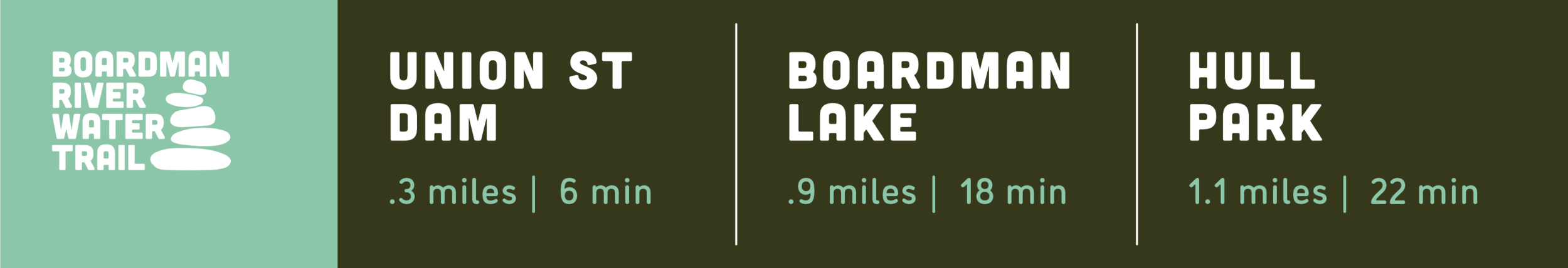
bridge-mounted guides
These overhead guides communicate distances and travel times to destinations along the water trail route. The Boardman River is traversed several times by vehicular and pedestrian bridges — providing many opportunities to mount these subtle guide signs in locations highly visible to paddlers.

Interpretive graphics
The Boardman River hosts a diverse ecosystem and has a rich history. Interpretive graphics located along the trail allow for story telling that will add color to paddler’s outings.

Water Trail Navigation App
A downloadable app and GPS-enabled map allow trail users to take the official BRWT map with them — ensuring navigation and amenity information is always at hand.

Logo
This bold logo helps the BRWT build its brand across all forms of communication — signage, promotions and collateral.

Mapping
A crystal clear map is essential in orienting and preparing paddlers for a successful outing. This curated map provides all the information a paddler wants and without unneeded clutter often found on less targeted maps. Amenities relevant to paddlers — food, dining, restrooms, etc. — are highlighted. The map also highlights portages and challenges of specific interest to paddlers.

DOCUMENTATION AND SPECIFICATION
Clear specifications and detailed documentation keeps the program logic and design intent intact through the fabrication and installation phases.


Boardman Lake at Hull Park
Project Credits
Wayfinding Design - Gene Ullery-Smith
Client - Traverse City DDA